Using Drone to take stock pile measurement
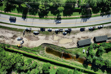
In recent years, use of drones for commercial activities has increased due to government permission to fly certified and licensed drones in Florida. Civil contractors and builders have been the earliest people to adopt use of drone survey to map their project area, take pictures of their project area, and to take stock pile measurement of various materials lying in their project area. Today, various industries that have outdoor stock which is difficult to measure and is spread over a vast area, use drone survey to map their project area, take pictures of the entire land and built area, and also make stockpile reports using data collected through drone survey and their special software. Accurate stockpile report Many people doubt about the accuracy of stock pile reports generated by drone survey, but they fail to understand that technology that is being used today is very accurate and supported by special software created especially for such purposes. A few years ago, ...