Utilize Drone Aerial Surveying and Mapping Service for your Business
Drones Offer Limitless Possibilities
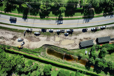
Aerial surveying by drones provide a clear and accurate picture of the area to be mapped through aerial imaging. It has become an important tool for creating 2D and 3D models for industries that need surveying, for construction companies and general contractors as drones save a significant amount of time, expedite workflow and save on manpower.
Aerial surveying via drone mapping is very helpful for businesses that need information about the frequent change in areas or project progress regularly as it is a more cost-effective technology than using manned aircraft's. Construction projects, mining sites, road works, coastal area monitoring are some places that need surveying frequently.

Drones gather data at a remarkable speed with the help of high-resolution cameras and specialized software convert the data to a 3D map for of any surface such as a topographical map, terrain model, etc. Having detailed data and 3D maps can help you visualize and make informed decisions for better profitability.
Drone surveying can gather volumetric measurements; analyze Stockpile Measurement of raw materials, inventory asset calculations, measure landfill capacity, detailed storm water and drainage survey, design golf course, etc.
Choosing the Right Drone Mapping Service is Important
Many businesses employ drone services to accomplish their projects, you may be one of them, needing a competent drone operating service. However, you will have to determine the right drone service provider after considering some important points.
The first and foremost thing that you must consider is that the service provider is licensed and insured. The pilot should be trained, qualified and certified to tackle any harsh climate conditions so that the aerial survey can be implemented swiftly. Drone pilots should be experienced to handle all sort of internal or external risks especially in mining exploration.
Go Through Their Previous Works and Resources
For a Miami survey, it is a sensible idea if you ask the service provider for their experience in a similar requirement like yours so that he can fulfill your expectations. It is also beneficial if you go through some of their recent surveys and mapping that indicate their expertise in the field. This will also give you an idea about the kind of resources they have in this business.
Check on Their Efficiency and Constraints
It is important to find out ifa certain drone service provider can deliver the kind of service you expect during a Tampa survey. It is possible that a service provider does not possess high tech equipment, some may be less experienced in tackling your kind of project, some may not have the necessary skills, enough workforce or is simply too expensive. Hence, it is important to weigh their efficiency as well as constraints to make the right decision for Orlando survey. This will further prevent time delays, chances of inaccurate or unreliable data and extra expenses.

Go through reviews and testimonials specifying on the service providers experience, resources, equipment to ensure whether they can match your deadlines and specifications. Also, get conscious about their service charges beforehand to improve transparency and have a steady relationship.
Florida Aerial Survey Technologies is a leading drone aerial surveying company. They are licensed and insured to serve all of Florida.
Comments
Post a Comment